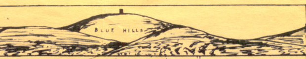
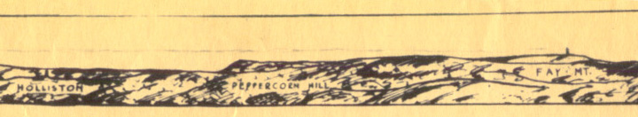
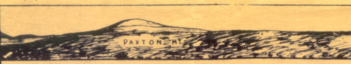
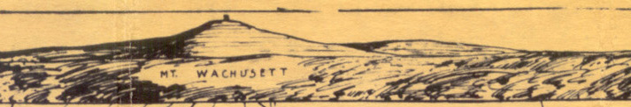
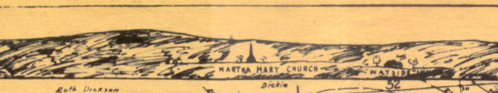
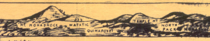
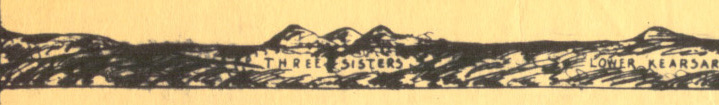
Full Res View to the East.
![]()
Full Res View to the East.
![]()
Full Res View to the West.

Full Res View to the North.

Full Res View to the South.
![]()
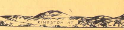
Juxtaposition of the 1928 hand drawn panorama inset into the 2008 panorama with a few more annotations.
East:
nobpane1.jpg,
nobpane2.jpg,
nobpane3.jpg,
nobpane4.jpg,
nobpane5.jpg,
nobpane6.jpg,
South:
nobpans1.jpg,
nobpans2.jpg,
nobpans3.jpg,
nobpans4.jpg,
West:
nobpanw1.jpg,
nobpanw2.jpg,
nobpanw3.jpg,
nobpanw4.jpg,
nobpanw5.jpg,
nobpanw6.jpg,
North:
nobpann1.jpg,
nobpann2.jpg,
nobpann3.jpg,
nobpann4.jpg,
https://www.jch.com/tipplingrock/nobpan.html <> YON - Jan C. Hardenbergh created 6-DEC-01; updated 2008.09.14
