Historical Maps <> Sudbury <> Massachusetts <> More Sudbury Maps <> Sudbury Historical Society (SHS) <> Sudbury Archives <> list of maps <> jch.com <> YON

Historical Maps of Sudbury, MA

This is a raw page of the maps from the book, which is available from Sudbury Historical Society (SHS). See Historical Maps of Sudbury webpage for more info. You can check out a Low-Res Proof.

The book can be viewed at the Goodnow Library. Cataloged as Historical maps of Sudbury, Massachusetts / Jan C. Hardenbergh It is for sale at the Sudbury Historical Society (SHS).

image CoverArt20200511.jpg
image GrantsOverWalling1856Map.jpg
Sudbury Grants Overlay
Walling 1856 Map
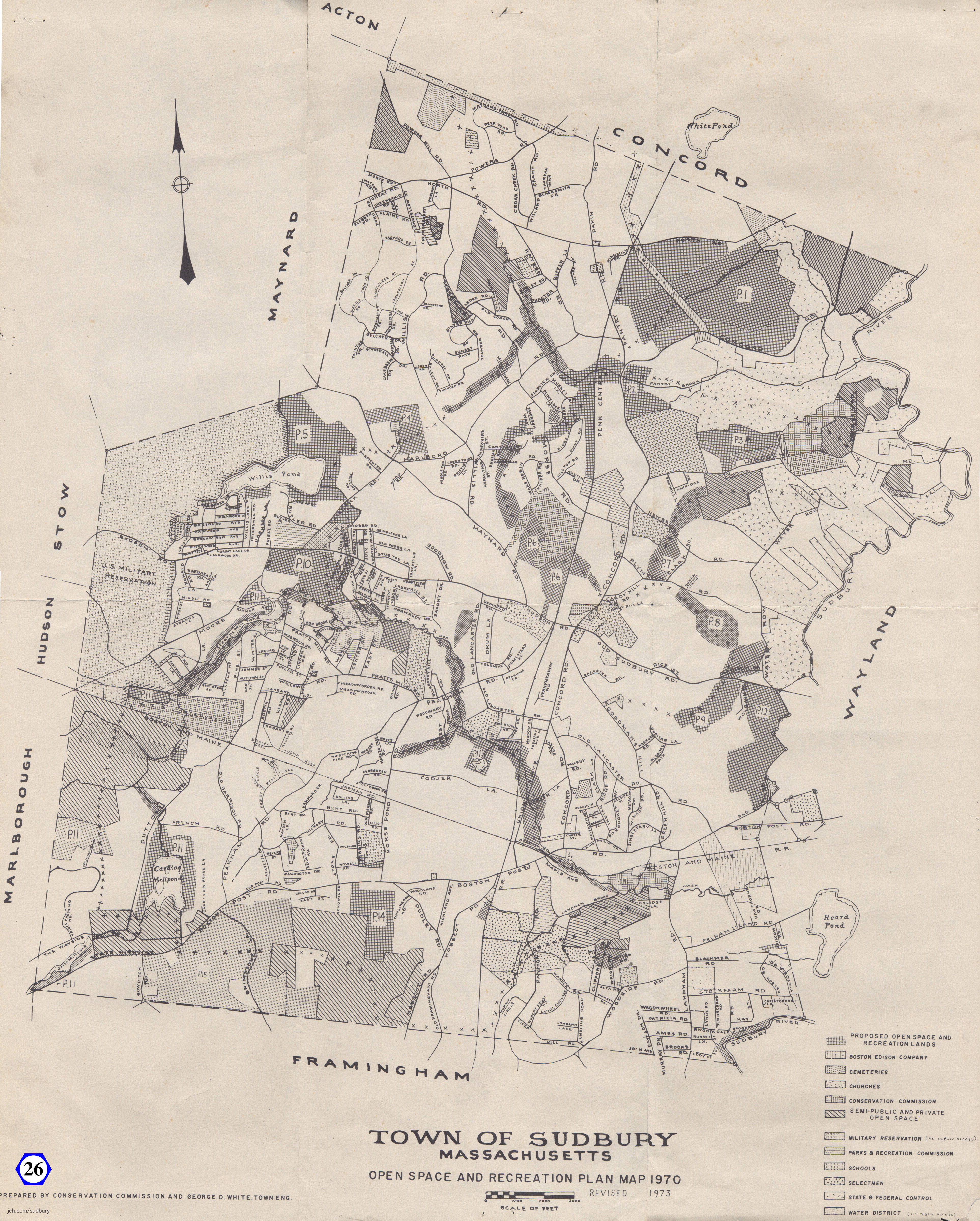
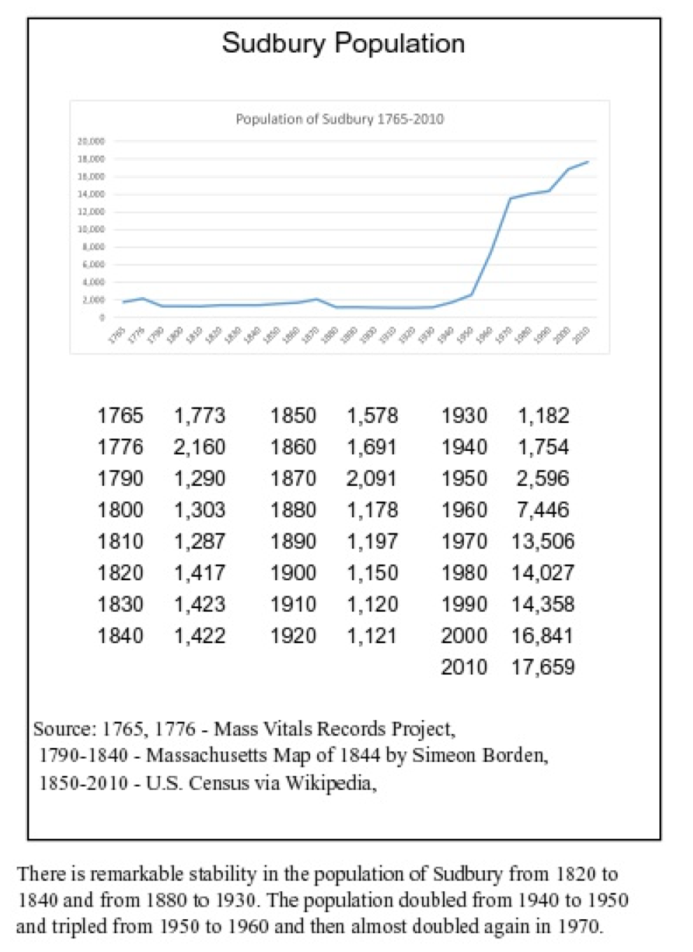
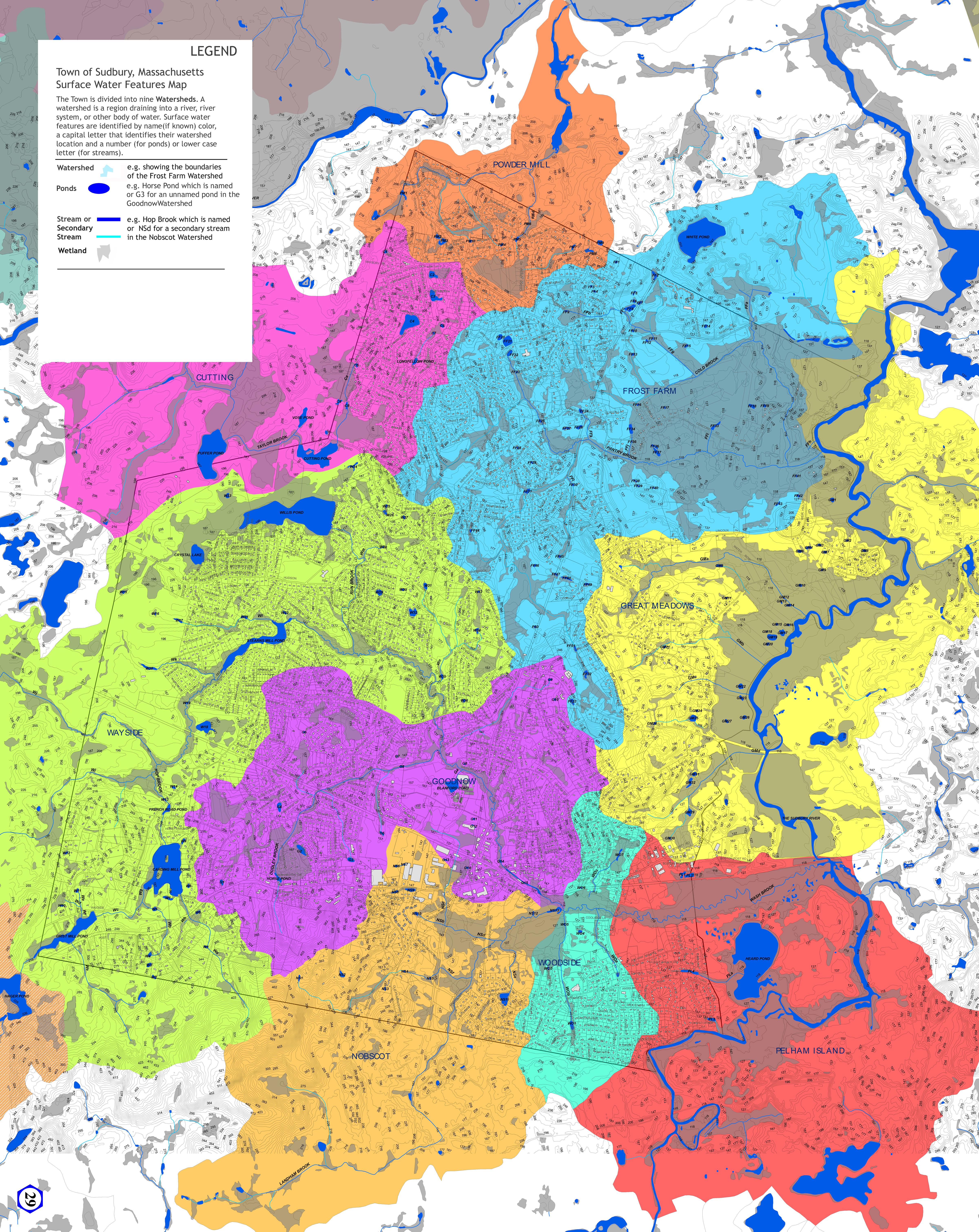
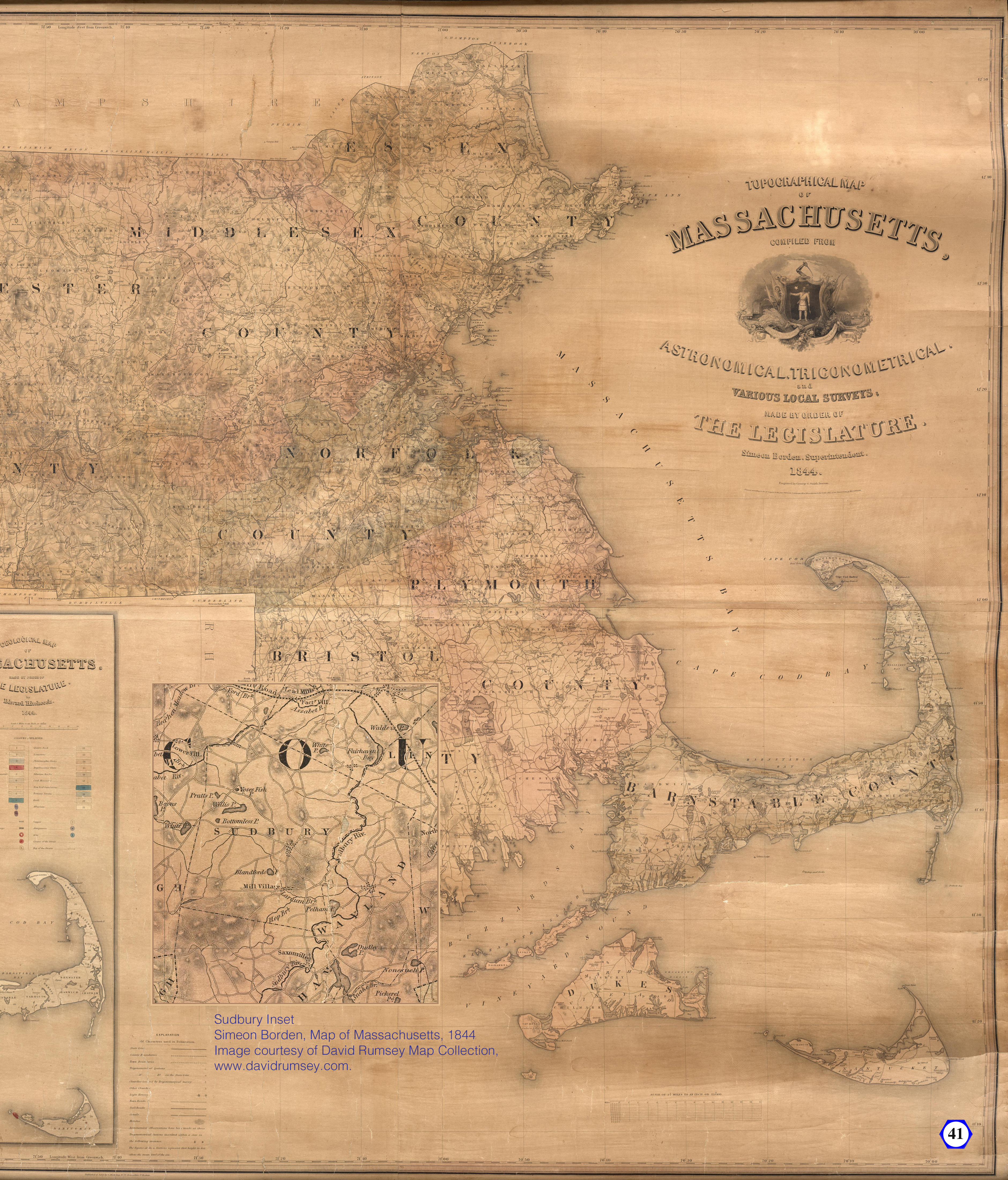
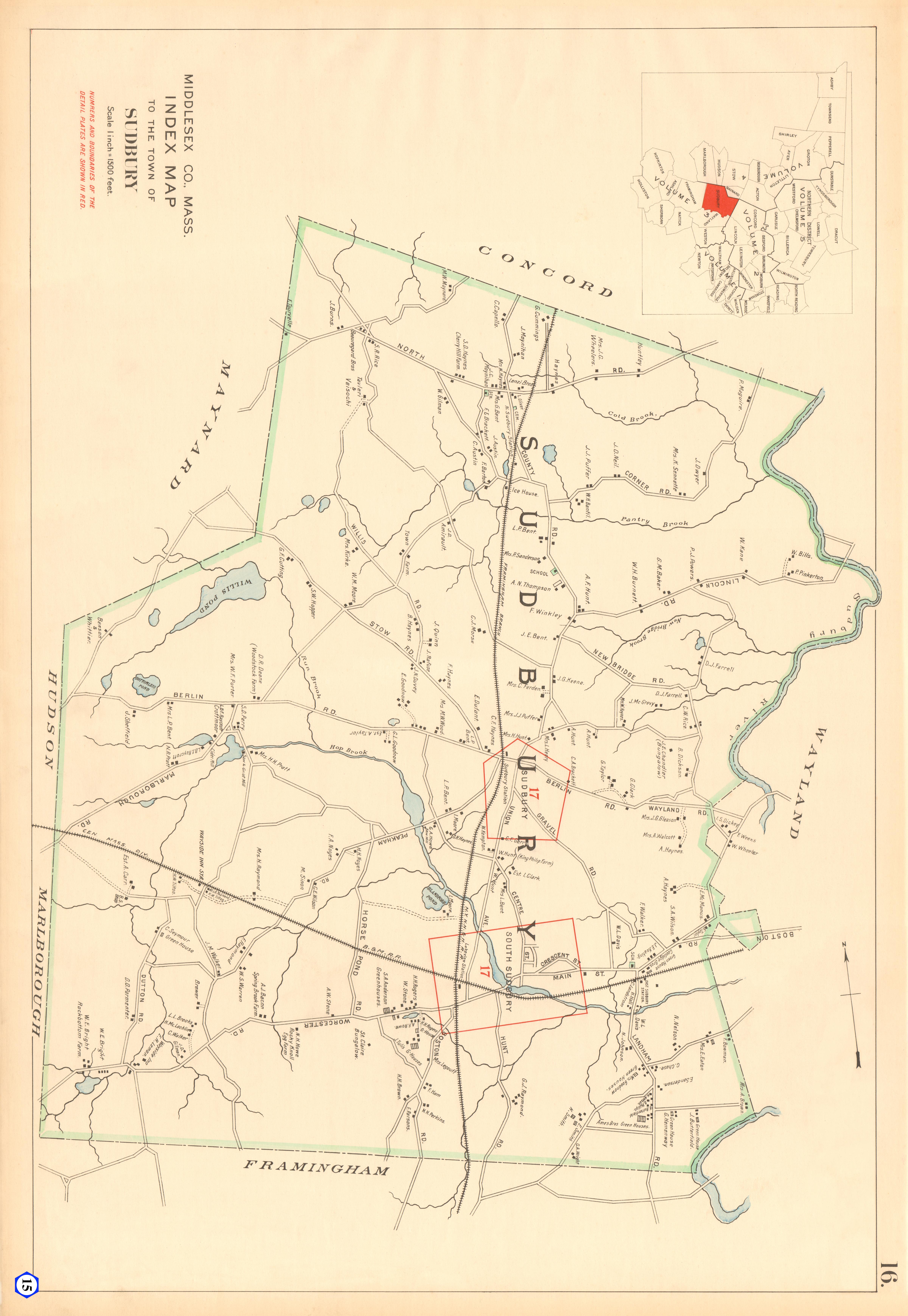
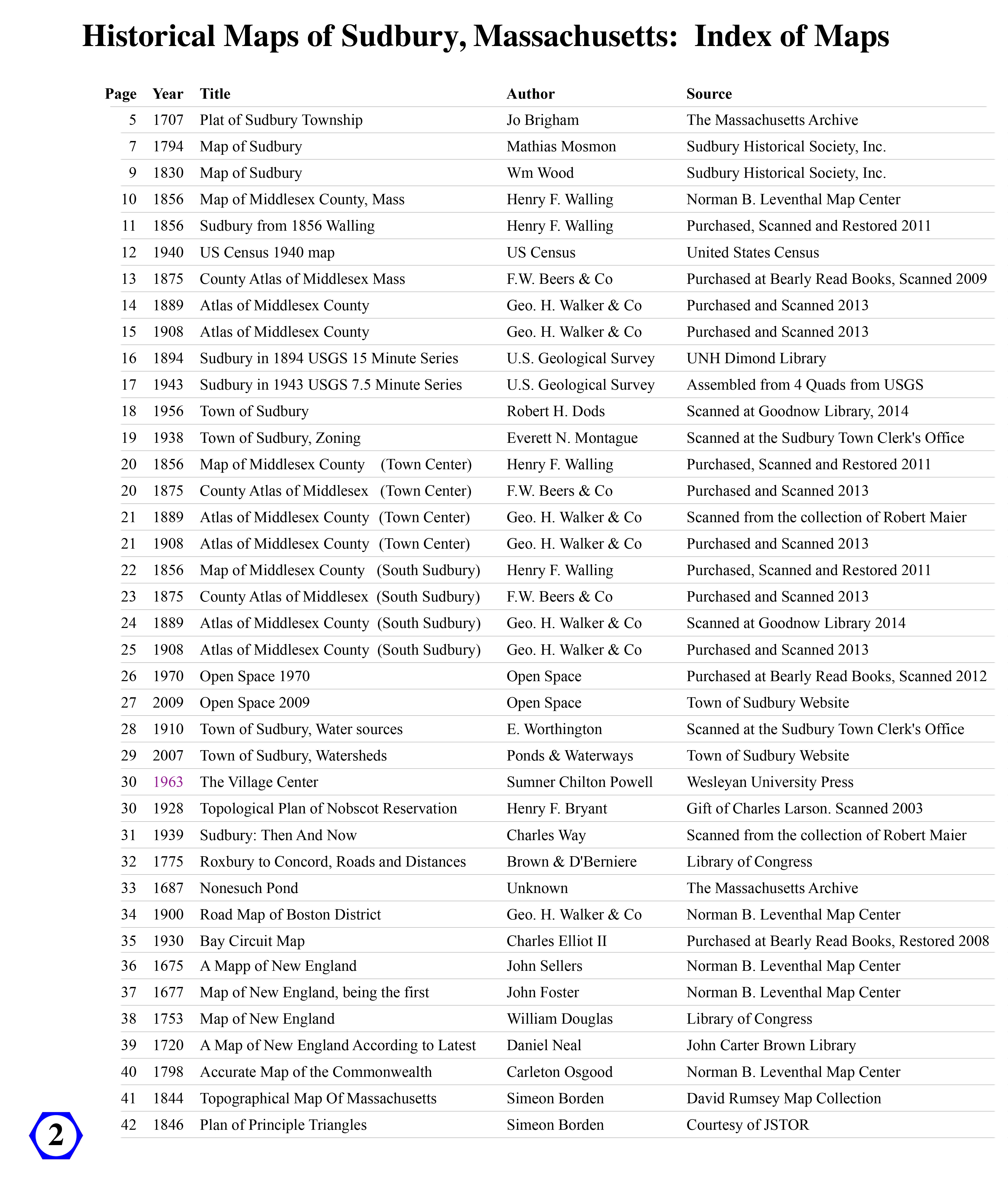
image MapBookIndex20200725.jpg
2020 Map Book Index
image TribalTerritoriesNikater.png
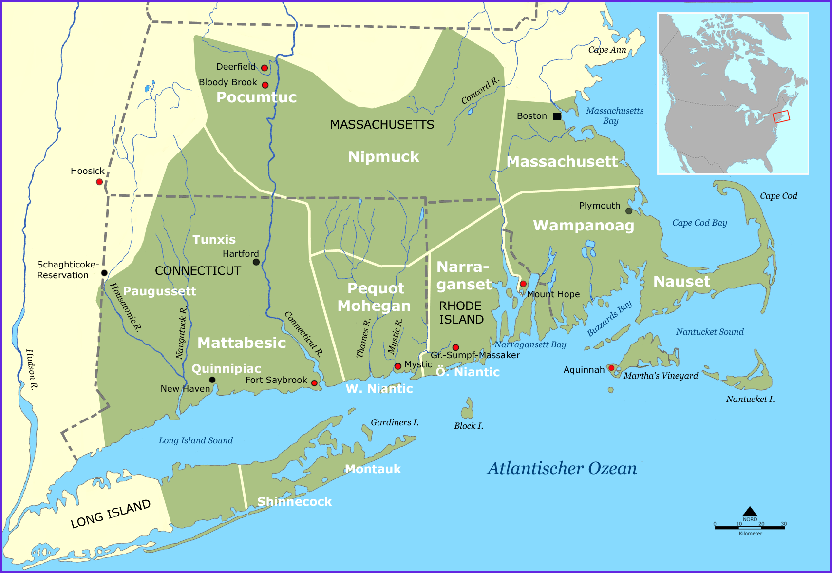
TribalTerritoriesNikater.png - 1708x1176
image NonesuchPond1687MassArchive4340x3600.jpg
Nonesuch Pond 1687
MassArchives - 4340x3600
image Sudbury1707Brigham3832x4800.jpg
Sudbury 1707 Brigham
image SudburyMosmanStateArchive3267x4800.jpg
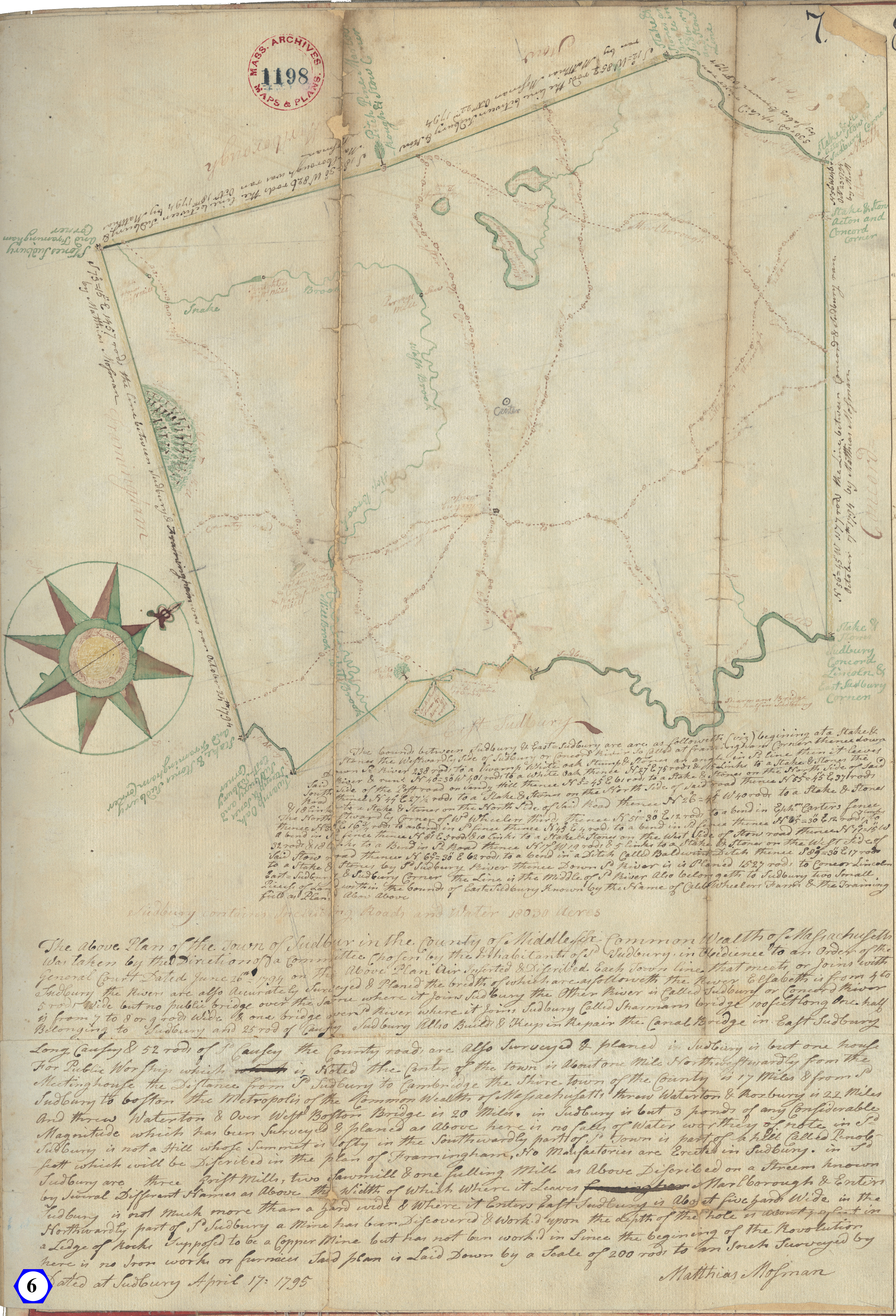
Sudbury Mosman State Archive
image SHSMosmanSudbury1794_4500x3600.jpg
Mosman Sudbury 1794
Restored by Chuck Zimmer
Sudbury Historical Society
image SHSWoodSudbury1830_5600x4218.jpg
SHSWoodSudbury1830 2400
image Sudbury1856Walling6398x4800.jpg
Sudbury1856Walling6398x4800.jpg - 4800x6398
image Sudbury1875Beers6040x4800.jpg
Sudbury1875Beers6040x4800.jpg - 4800x6040
image Sudbury1889WalkerCrop4100x4800.jpg
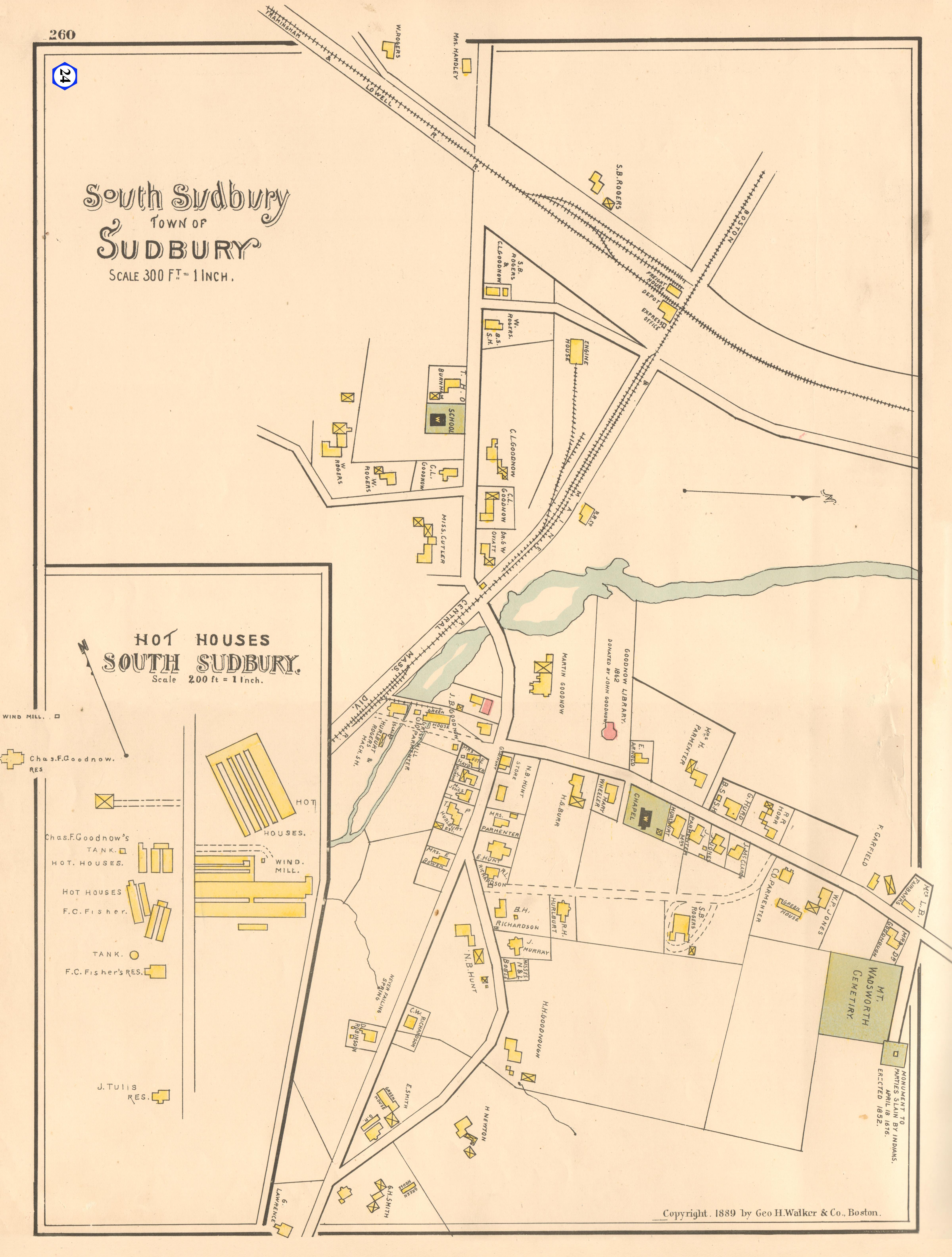
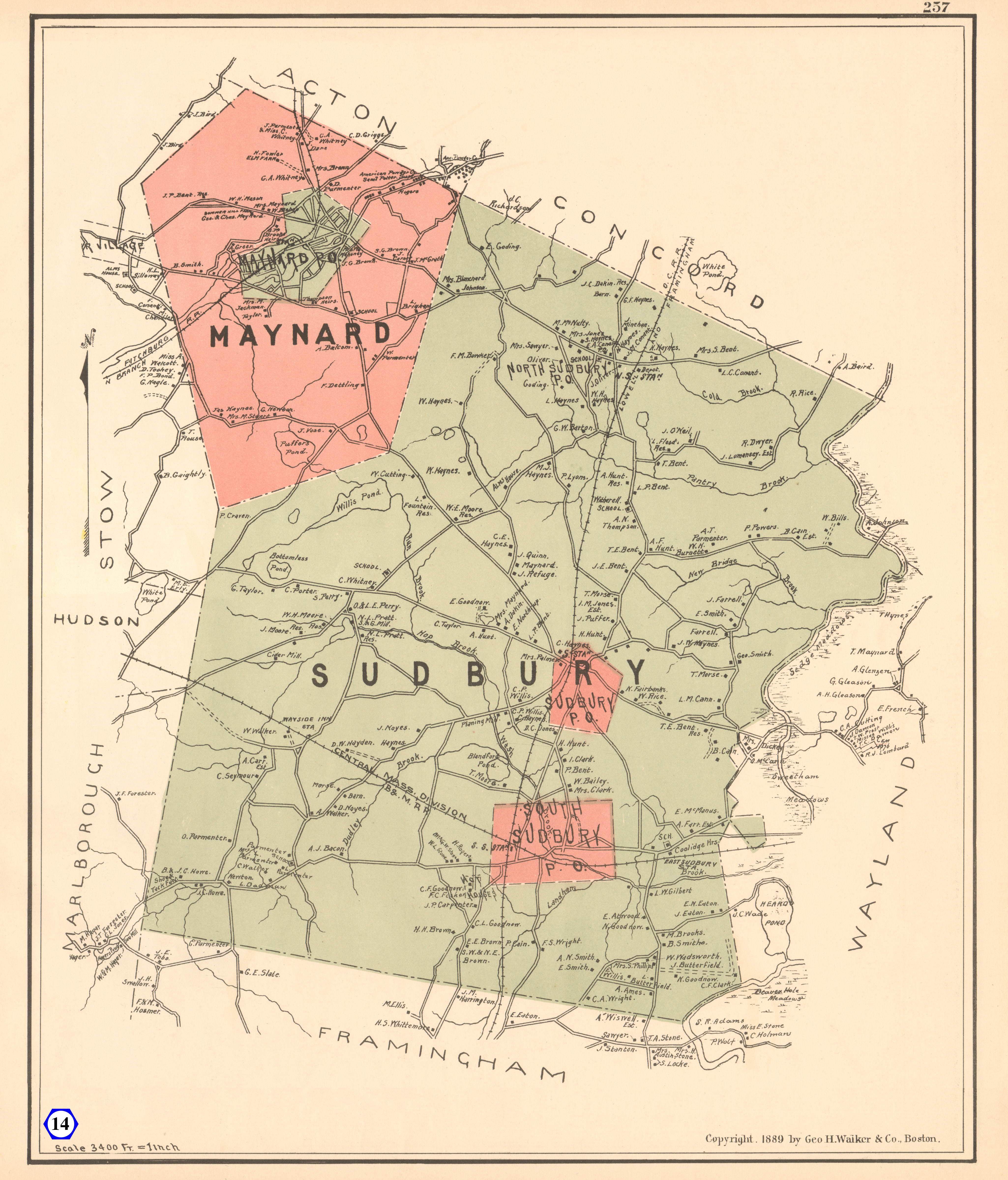
Sudbury1889WalkerCrop4100x4800.jpg - 4100x4800
image Sudbury1894USGS15border.jpg
Sudbury1894USGS15border.jpg - 1458x1824
image Sudbury1908Walker6960x4800.jpg
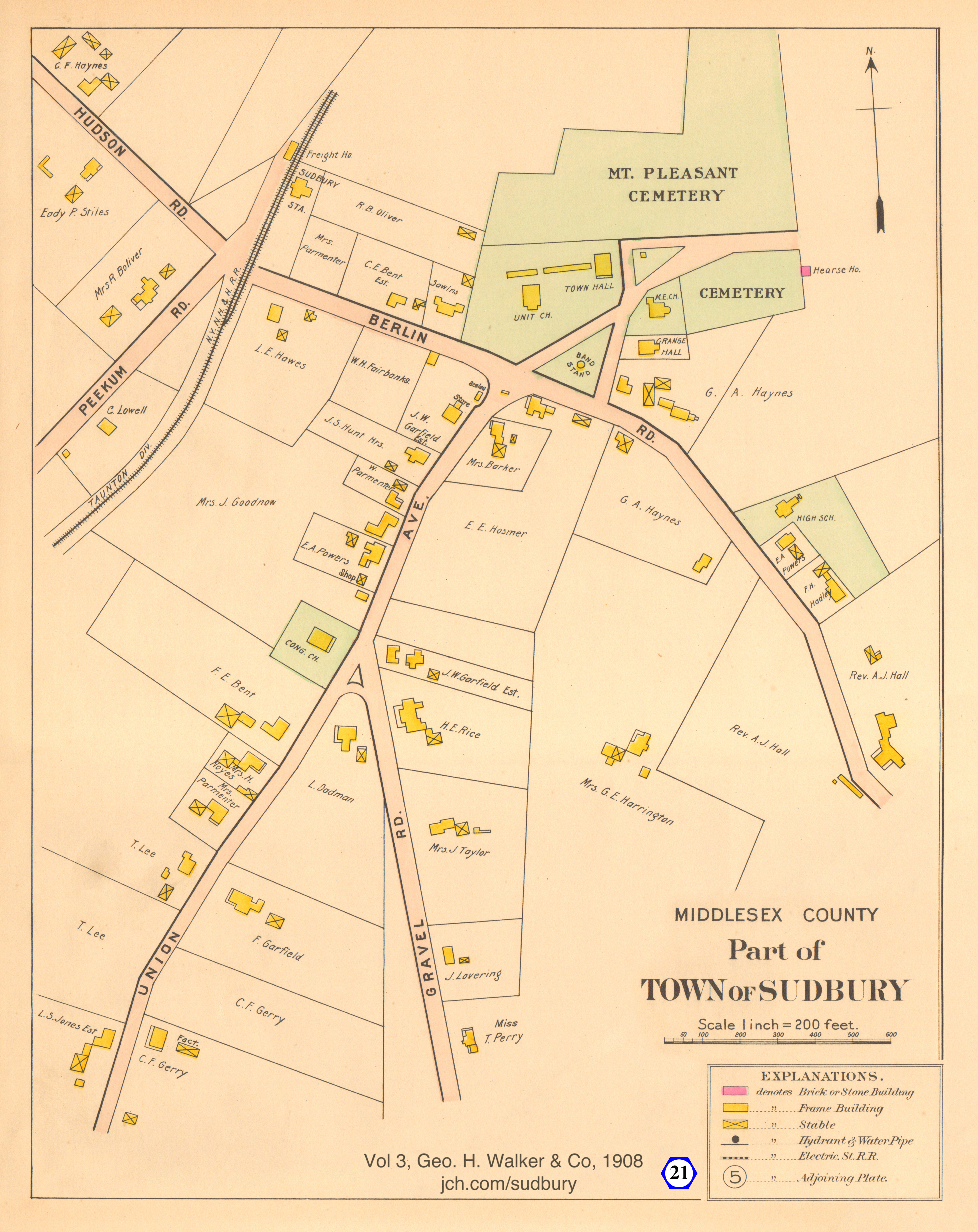
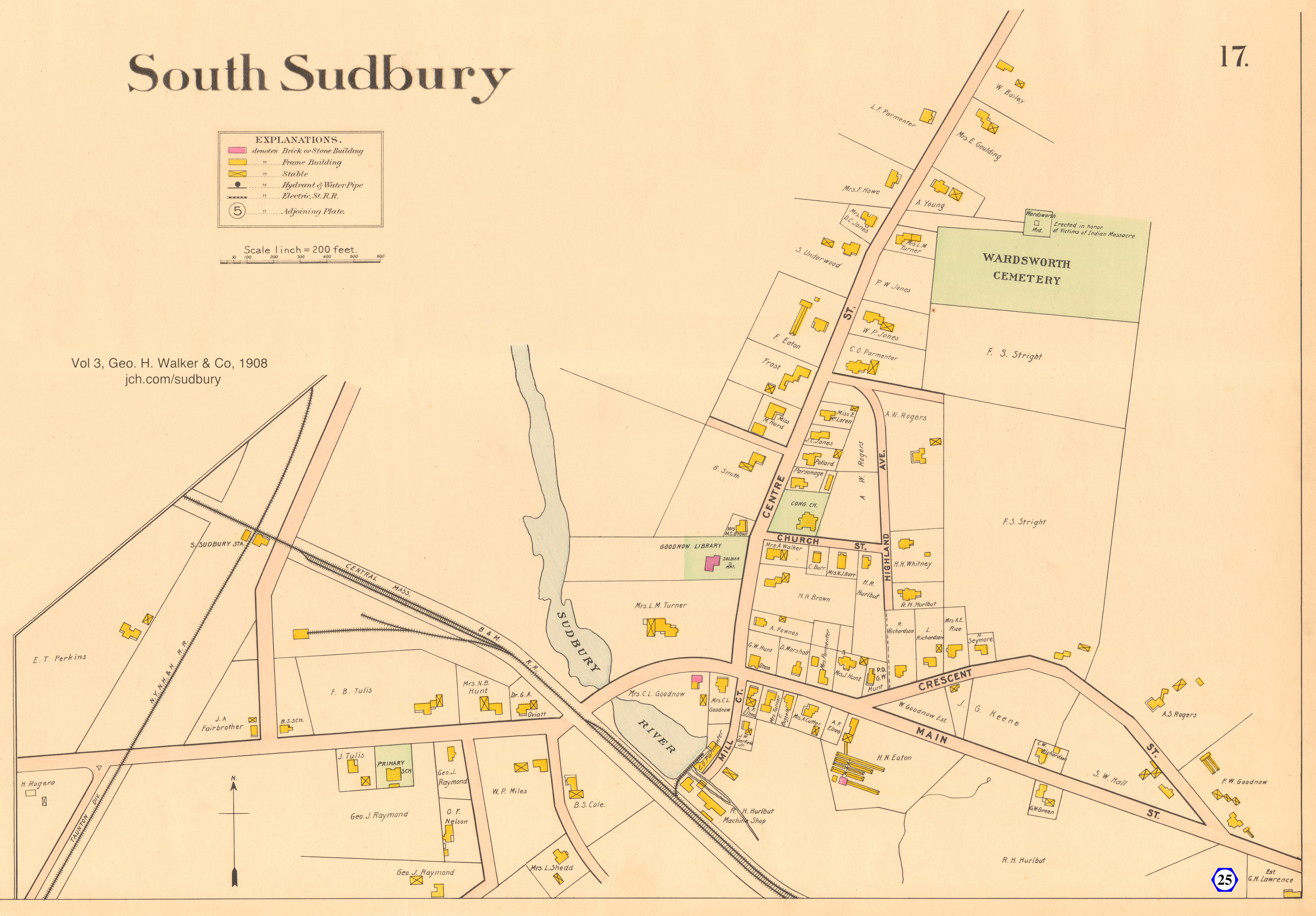
Sudbury1908Walker6960x4800.jpg - 4800x6960
image Sudbury1910water4400x4800.jpg
Sudbury1910water4400x4800.jpg - 4400x4800
image Sudbury1943USGSrot_6345x4800.jpg
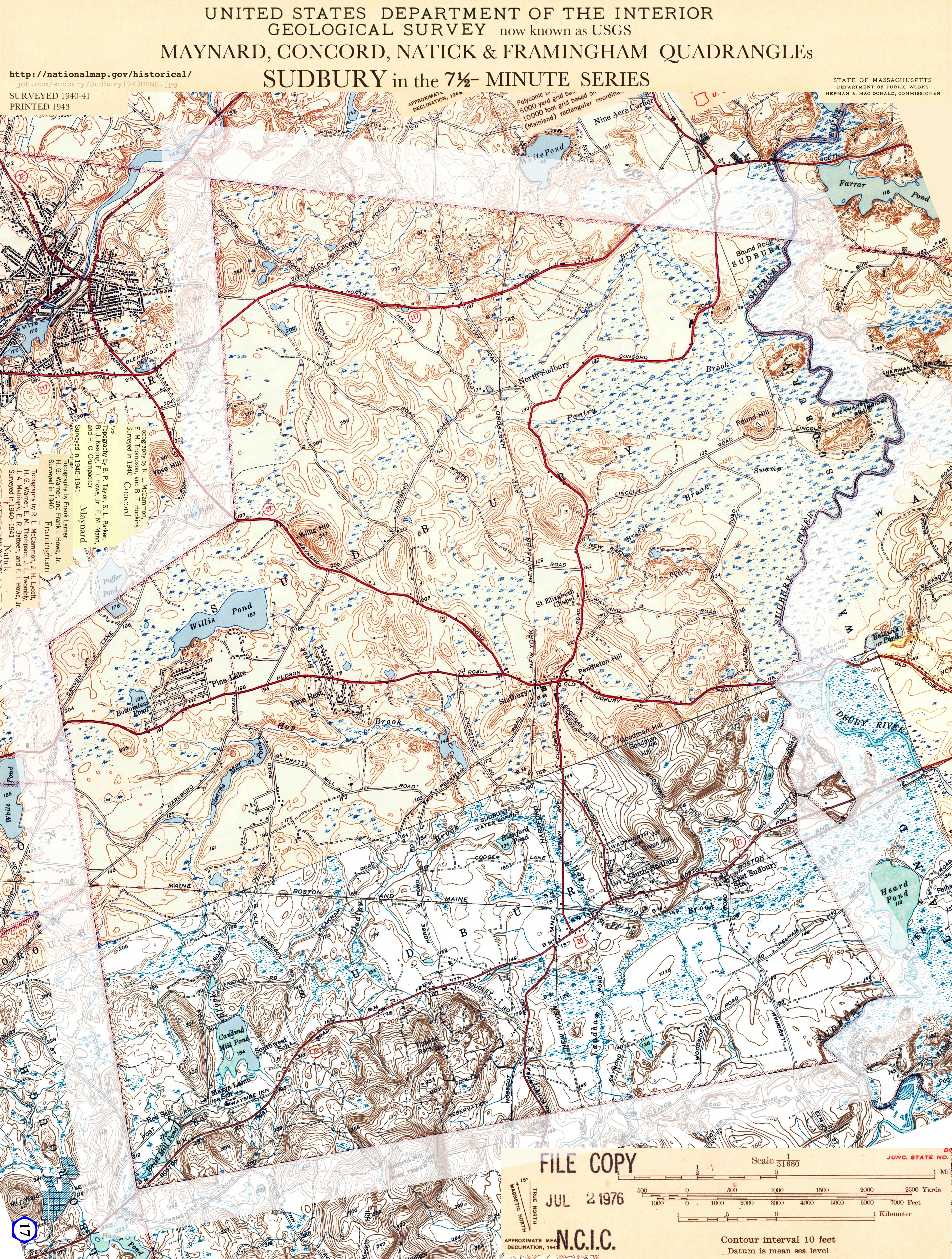
Sudbury1943USGSrot_6345x4800.jpg - 4800x6345
image Sudbury1983Zoning6560x4800.jpg
Sudbury1983Zoning6560x4800.jpg - 4800x6560

Town Center

image SudburyCenter1856Walling1183x1391.jpg
SudburyCenter1856Walling1183x1391.jpg - 1183x1391
image SudburyCenter1875Beers2560x2935.jpg
SudburyCenter1875Beers2560x2935.jpg - 2560x2935
image SudburyCenter1889GeoHWalker2800x3416.jpg
SudburyCenter1889GeoHWalker2800x3416.jpg - 2800x3416
image SudburyCenter1908Walker3812x4800.jpg
SudburyCenter1908Walker3812x4800.jpg - 3812x4800

South Sudbury

image MillVillage1856Walling1310x1400.jpg
MillVillage1856Walling1310x1400.jpg - 1310x1400
image SouthSudbury1875Beers4392x3388.jpg
SouthSudbury1875Beers4392x3388.jpg - 4392x3388
image SouthSudbury1889Walker6300x4800.jpg
SouthSudbury1889Walker6300x4800.jpg - 4800x6338
image SouthSudbury1908Walker6900x4800.jpg
SouthSudbury1908Walker6900x4800.jpg - 6900x4800

Other Maps of Sudbury

image OpenSpace1970_3852x4800.jpg
OpenSpace1970_3852x4800.jpg - 3852x4800
image OpenSpace2009updated5828x4800.jpg
OpenSpace2009updated5828x4800.jpg - 4800x5828
image SudburyThenAndNowBobRB3935x4480.jpg
SudburyThenAndNowBobRB3935x4480.jpg - 3953x4480
image Sudbury_US_census_map_1940_3975x4800.jpg
Sudbury_US_census_map_1940_3975x4800.jpg - 3975x4800
image TC1913layout_2560x1456gray.jpg
TC1913layout_2560x1456gray.jpg - 2560x1456
image SudburyPopulation_1765_2010.png
SudburyPopulation_1765_2010.png - 992x1362
image Sudbury1956Dods6296x4800.jpg
Sudbury1956Dods6296x4800.jpg - 6296x4800
image WaterTopoParcels6040x4800.jpg
WaterTopoParcels6040x4800.jpg - 4800x6040

Early Maps

image Osgood1796fromLeventhal6519x4800.jpg
Osgood 1796 from Leventhal
image Borden1844x6734x4400inset.jpg
Borden 1844
image BordenTriangles5372x3200.jpg
Borden Triangles
image Walling1856fromLeventhal4900x4800.jpg
Walling 1856 from Leventhal
image Seller_1675_from_Leventhal6000x4800.jpg
Seller_1675_from_Leventhal6000x4800.jpg - 6000x4800
image Douglass_5240x4800.jpg
Douglass_5240x4800.jpg - 5240x4800
image Foster_1677_cj82m298g_fromLeventhal4280x3200.jpg
Foster_1677_cj82m298g_fromLeventhal4280x3200.jpg - 4280x3200
image Neal00016002_5880x3934.jpg
Neal00016002_5880x3934.jpg - 5880x3934
image RoxburyConcord1775_6800x3200.jpg
1775 Spy Map
Roxbury Concord
image BayCircuitMap1930_6784x4800.jpg
BayCircuitMap1930_6784x4800.jpg - 4800x6784
image WalkerRoadMap1900_6480x4800.jpg
WalkerRoadMap1900_6480x4800.jpg - 6480x4800
image FloodPlain2465x2800.jpg
FloodPlain2465x2800.jpg - 2465x2800
image PowellTheVillageCenter3000x2400.png
PowellTheVillageCenter (small due to copyright)
image Nobscot20200511.jpg
Nobscot20200511.jpg - 2960x3488
update 2023-04-13 - created 15 Aug 2020