
Sudbury Population 1765 - 2020
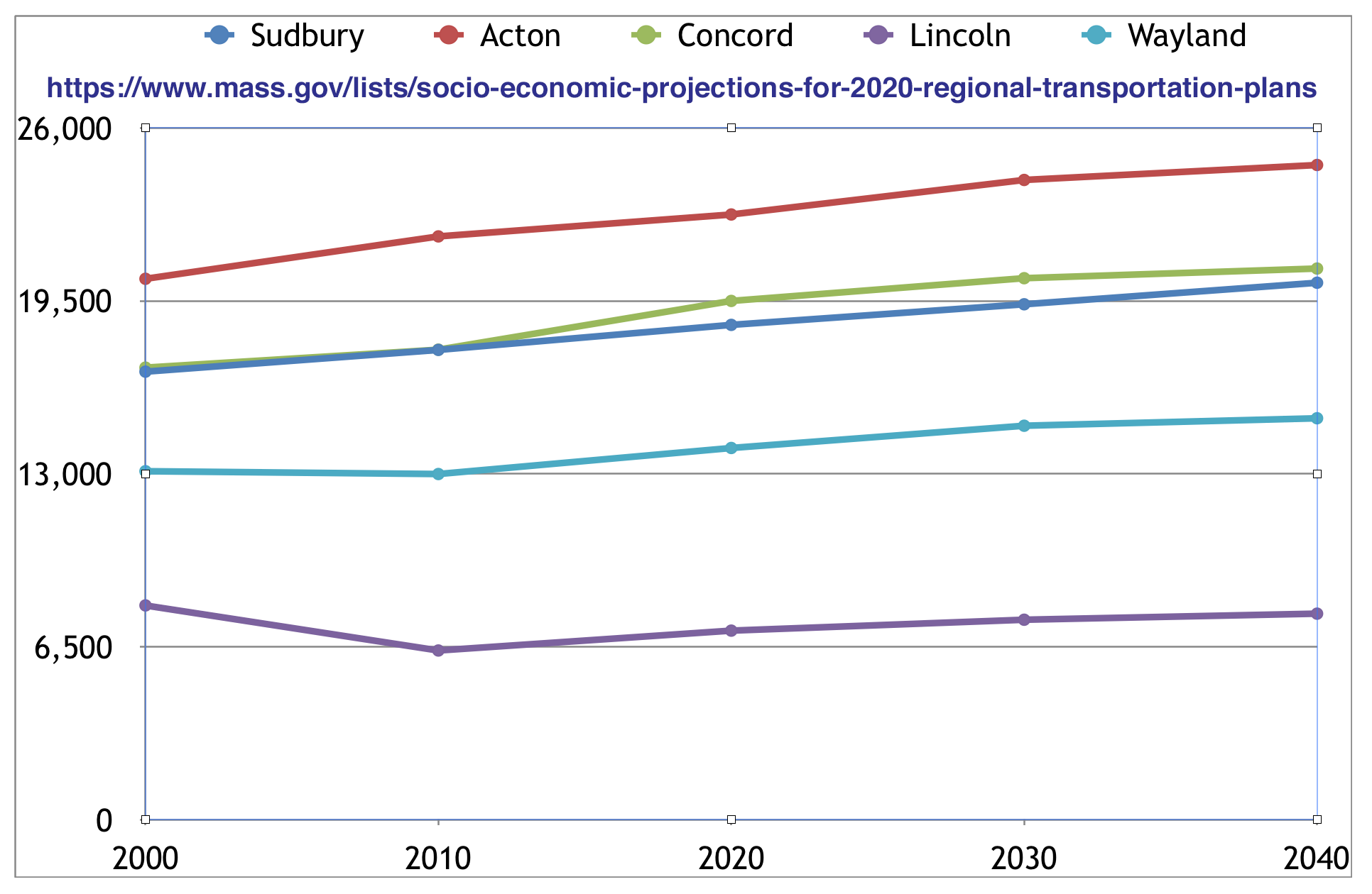
Population in 2040 from Mass DoT
Sudbury 2020 in US Census and Sudbury in Census Reporter
| Sudbury Population 1765 - 2020 |
Population in 2040 from Mass DoT |
The MAPC Projections found in 190405_SudburyMP_BLR_CommunityProfile.docx shows the population dropping to 17,131 in 2020 and 17,153 in 2030. The Mass DoT projections are quite different: 18,599 (2020), 19,373 (2030), 20,183 (2040).
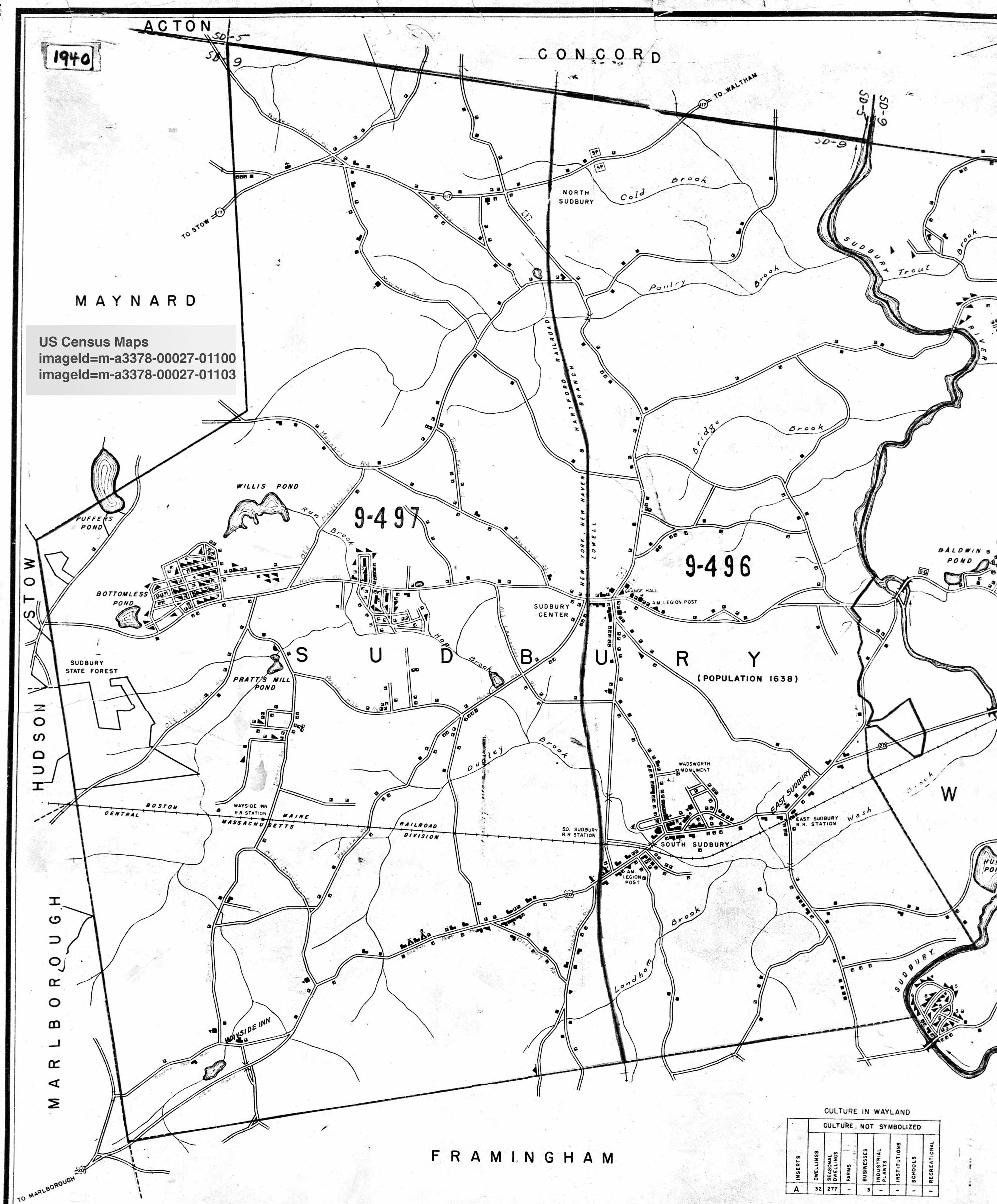
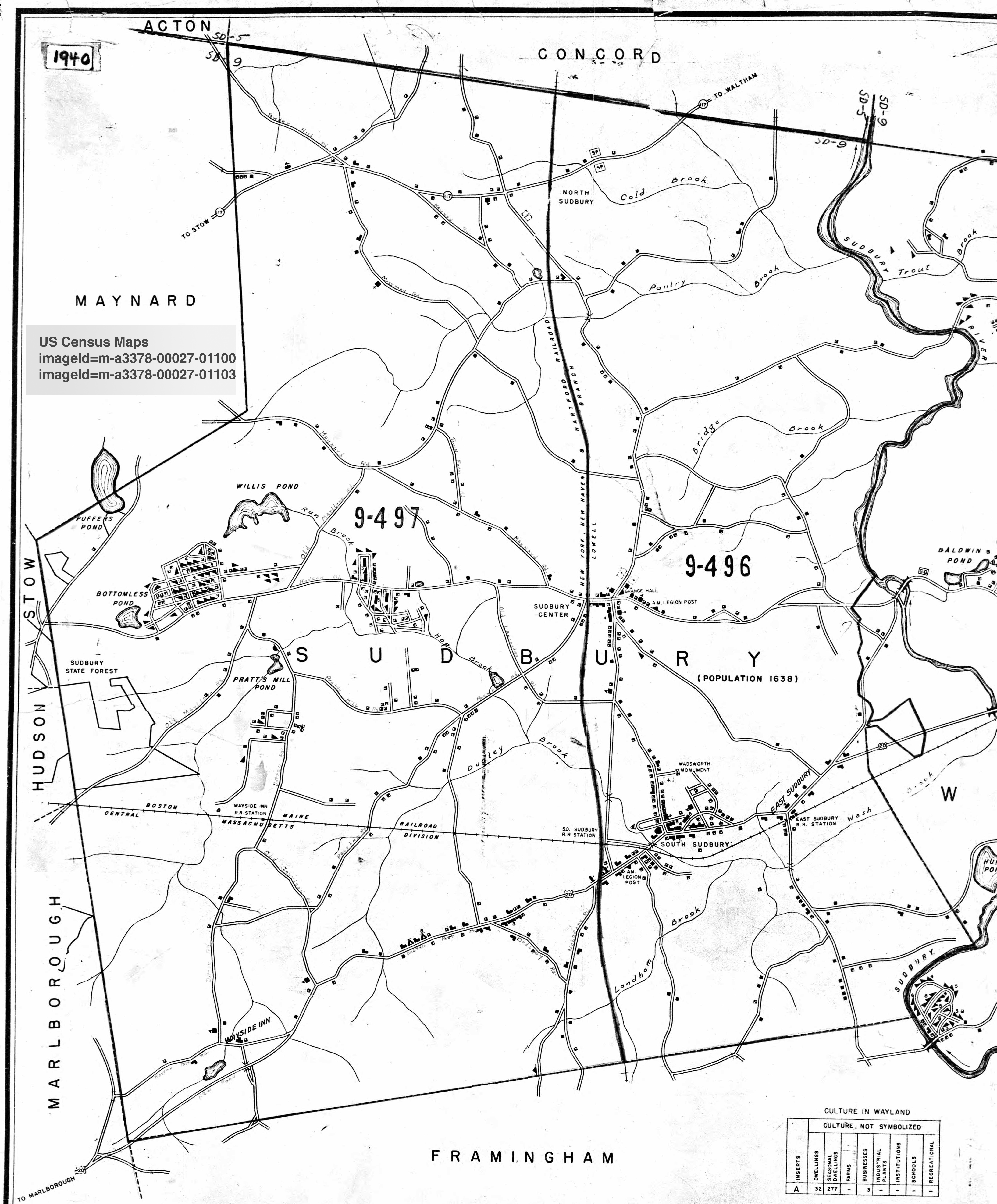
Sudbury 2018 census was 18,173 - from the Town website. It was mailed to 6583 households. After going through the pages of the 1940 US census pages, I came up with 490 households in 1940 and a population 1753. More on 1940 census below.
The searching and indexing of the 1940 census data is not a priority of the U.S. government, evidently. Perhaps to give various geneology sites an advantage? Link thru to census map. I found this useful: Unified Census ED Finder.
 m-t0627-01617-00736.jpg - 7444x5484 |
 m-t0627-01617-00785.jpg - 7348x5500 |
created 2019-05-20 <> jch